Visitor guide · 27 landmarks

Saltash is worth the hill

Saltash climbs a steep hill up from the water, and every yard of it is worth the walk. Start at the station, fall down Fore Street to the river, and look up.

  1. 01Railway bridge / engineering landmark50.4077° N · 4.2035° W

    Royal Albert Bridge

    Brunel's last great work, and the reason most people first look up at Saltash.
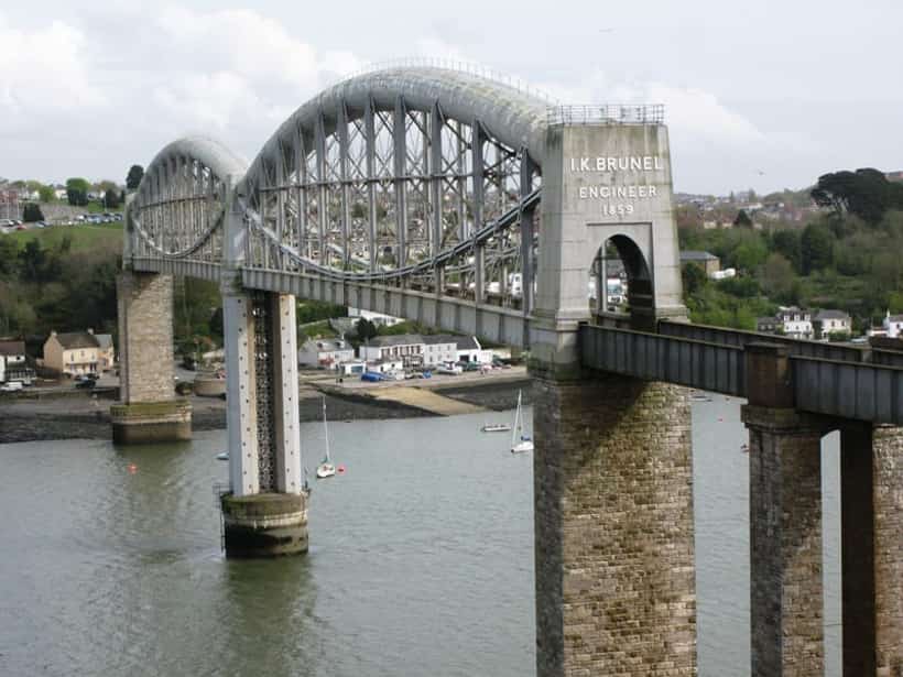
    Royal Albert Bridge
    Wikimedia Commons (via Wikipedia infobox)

    Designed by the celebrated engineer Isambard Kingdom Brunel, the Royal Albert Bridge carries the main railway line across the River Tamar between Saltash and Plymouth, marking the historic boundary between Devon and Cornwall. Surveying for the crossing began in 1848, but construction did not start until 1854 due to funding difficulties for the Cornwall Railway. The bridge's distinctive design uses two 455-foot lenticular (curved, lens-shaped) wrought-iron trusses, each acting like a bowstring, combined with suspension chains, resting on a central pier sunk into the riverbed using a pioneering pneumatic caisson method. The bridge stands 100 feet above the water to allow Royal Navy ships to pass beneath. It was formally opened by Prince Albert, Queen Victoria's consort, on 2 May 1859, and bears the inscription 'I.K. BRUNEL ENGINEER 1859' at each end. Brunel himself was too ill to attend the opening ceremony and died later that year, making it one of his final and most celebrated works. The bridge remains in continuous use today for the Great Western main line and is a Grade I listed structure and scheduled monument, regarded as one of the finest surviving examples of Victorian railway engineering.

    Best seen from the Waterside, directly beneath the eastern span. Cross it by train from Plymouth.

    Between Saltash, Cornwall and Plymouth, Devon (crossing the River Tamar) · PL12 4BY
    Street View

  2. 02Suspension road bridge50.4083° N · 4.2036° W

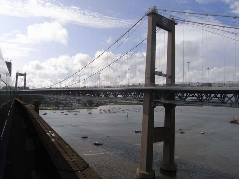
    Tamar Bridge

    The suspension bridge that ended eight centuries of ferrying people over the river.

    Tamar Bridge
    Wikimedia Commons (via Wikipedia infobox)

    The Tamar Bridge opened in 1961 as the first major suspension bridge built in Britain after the Second World War, constructed to replace the historic Saltash chain ferries that had carried road traffic across the Tamar for centuries. It was funded jointly by Devon County Council, Cornwall County Council, and Plymouth City Council, making it one of the earliest bridges owned and financed by a partnership of local authorities rather than central government. Running directly alongside Brunel's Royal Albert Bridge, it created a striking pairing of Victorian rail and modern road engineering side by side across the estuary. As traffic grew dramatically in the late twentieth century, the bridge underwent an ambitious widening project between 1999 and 2001, during which extra sections were added to each side while the bridge remained open to traffic throughout — a world-first engineering achievement for a suspension bridge of its kind. Today it carries the A38 trunk road and is one of the few toll bridges remaining in the UK, with tolls charged only on eastbound crossings into Plymouth.

    Footways run along both sides. Tolls are charged eastbound only — walking and cycling are free.

    A38, between Saltash, Cornwall and Plymouth, Devon · PL12 4BY

    Street View

  3. 03Civic building / historic hall50.4084° N · 4.2093° W

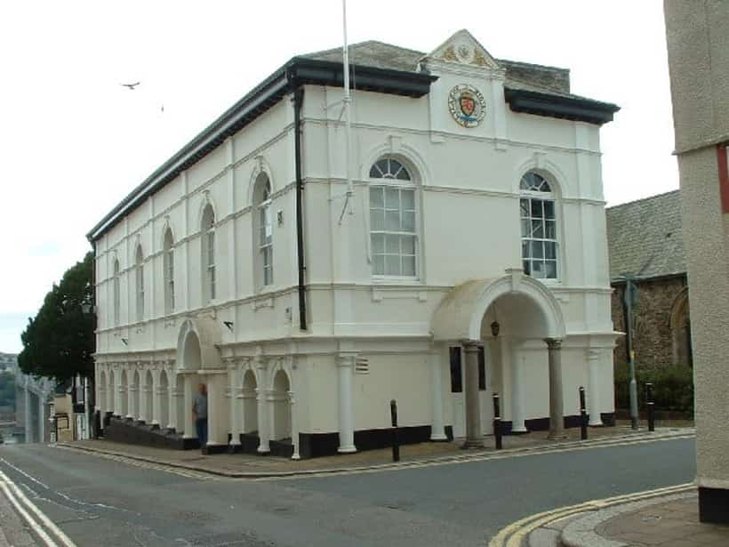
    Saltash Guildhall

    Georgian civic granite over the old market floor — and home to the embroidered Saltash Chronicles.

    Saltash Guildhall
    Geograph Britain and Ireland, via Wikimedia Commons

    Saltash Guildhall was built around 1780 on Fore Street, replacing an earlier medieval guildhall, and reflects Saltash's long-standing status as one of Cornwall's oldest boroughs, with a charter dating back to the twelfth century granted by the de Valletort lords of nearby Trematon Castle. The building served as the seat of the borough corporation, hosting council meetings, civic ceremonies, and courts for the historic Borough of Saltash. It was substantially extended and restored in 1925, adding to its civic grandeur while preserving its Georgian character. In more recent times the Guildhall has become home to the 'Saltash Chronicles', a large and intricately embroidered artwork created by local volunteers to depict key moments in the town's history, worked using the same type of wool thread as the famous Bayeux Tapestry. The Guildhall continues to serve as a focal point for civic life in Saltash and is a listed building recognised for its architectural and historical significance to the town's identity as an ancient borough on the banks of the Tamar.

    Market days and civic events. Tourist information inside.

    Fore Street, Saltash, Cornwall · PL12 6AH

    Street View

  4. 04Parish church50.4081° N · 4.2095° W

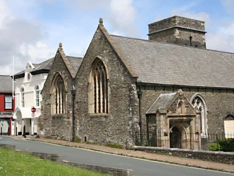
    Church of St Nicholas and St Faith

    Dedicated to the patron saint of travellers and sailors, which for a ferry town was only sensible.

    Church of St Nicholas and St Faith
    Geograph Britain and Ireland, via Wikimedia Commons

    The parish church of St Nicholas and St Faith stands on the site of a Norman chapel erected more than 800 years ago beside Saltash's central market square, when the borough's founder provided the growing riverside town with its own place of worship. It was dedicated to St Nicholas, the patron saint of travellers, sailors, and safe journeys — an especially fitting choice for a settlement whose entire existence revolved around the ferry crossing of the River Tamar. For more than 700 years the chapel remained subordinate as a 'chapel-of-ease' to the mother church of St Stephen, some distance away, meaning Saltash residents had no fully independent parish church of their own despite the town's importance as a trading and maritime centre. This changed in 1881, when, at the request of the Ecclesiastical Commissioners and the Bishop of Truro, the Privy Council issued an Order elevating the chapel to full parish church status, formally recognising Saltash's ecclesiastical independence. The church tower houses a clock dating from the early 1700s, one of the oldest working clocks in the area, and the building remains an active place of worship and a prominent architectural landmark on Fore Street.

    Active parish church. The tower clock dates from the early 1700s.

    Fore Street, Saltash, Cornwall · PL12 6AB

    Street View

  5. 05Parish church50.4038° N · 4.2292° W

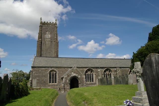
    St Stephen's Church

    The ancient mother church, older than the town — Saltash's whole parish belonged to it for seven hundred years.

    St Stephen's Church
    Photo by Kevin Hale, Geograph Britain and Ireland, CC BY-SA 2.0

    St Stephen's is the ancient mother church of Saltash, and older than the town it came to serve. It stands about a mile and a half from the Waterside, on the higher ground of St Stephens, and was probably founded in Norman times by the lords of Trematon Castle — a church is first recorded here in 1269, on a site consecrated in 1259, and Norman stonework survives in the fabric along with a square Norman font of a type found across Cornwall. Like the castle, the living passed to the Earls and then the Dukes of Cornwall, until in 1351 Edward III appropriated it to the Deanery of Windsor, so that its priests were thereafter presented by the Dean and Canons of St George's Chapel. For some seven hundred years the whole of Saltash lay within this parish: the chapel down in the town, dedicated to St Nicholas, was only a 'chapel-of-ease' subordinate to St Stephen's, and it was not until 1881 that Saltash gained a parish church of its own. Most of what stands today is fifteenth-century, a granite church with an embattled west tower, and it remains a Grade I listed building and an active place of worship at the head of its old churchyard.

    Active parish church up in St Stephens, a mile from the water. Grade I listed; Norman font, fifteenth-century tower.

    St Stephens Road, St Stephens, Saltash, Cornwall · PL12 4AP

    Street Viewsaltashteamministry.org/st-stephen-by-saltash.html

  6. 06Methodist church50.4094° N · 4.2171° W

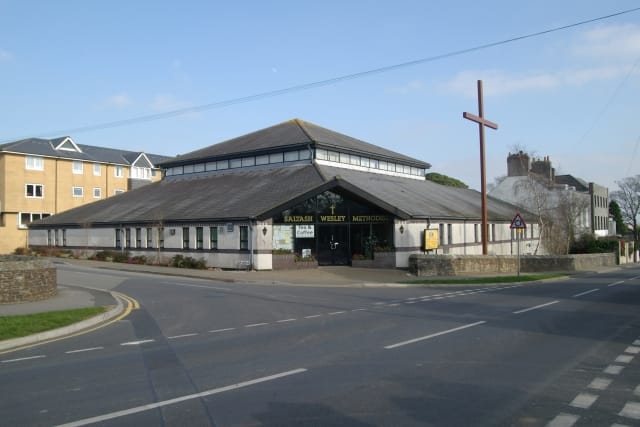
    Saltash Wesley Methodist Church

    The town's main Methodist church, and a community building — home to the music festival and the Memory Box sessions.

    Saltash Wesley Methodist Church
    Photo by Kevin Hale, Geograph Britain and Ireland, CC BY-SA 2.0

    Saltash Wesley is the town's principal Methodist church, standing just off Fore Street on the hill above the water, and named — as Methodist chapels so often are — for John Wesley himself, who rode into Cornwall to preach many times in the eighteenth century and left the county more thoroughly Methodist than almost anywhere in England. Nonconformity took deep root in the working communities of the Tamar, among the boatmen, quarrymen and railway workers whose lives left little room for the established church up the hill at St Stephens, and the chapel was built to serve them. Today Wesley is as much a community building as a place of worship: its halls host the Saltash Music Festival each January, the Memory Box singing sessions for people living with dementia, and a Community Kitchen, alongside the ordinary round of Sunday services — a reminder that in a small town the chapel has always been a social institution as well as a religious one.

    Just off Fore Street. Halls in regular community use through the week.

    Wesley Road, off Fore Street, Saltash, Cornwall · PL12 6DT

    Street View

  7. 07Gospel hall50.4133° N · 4.2356° W

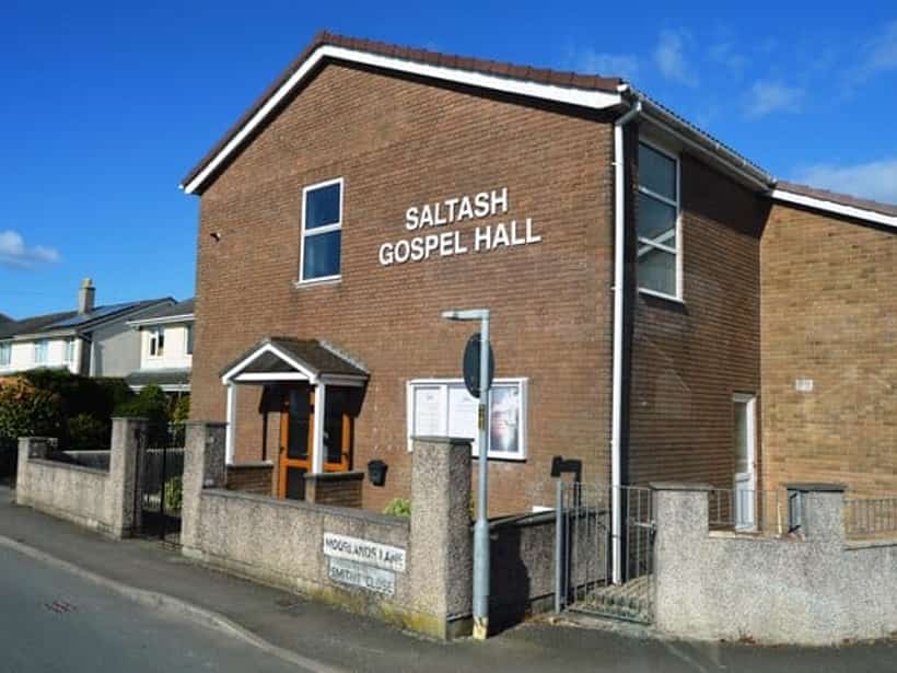
    Saltash Gospel Hall

    A plain Brethren meeting hall in Burraton, in the tradition that began just over the river in Plymouth.

    Saltash Gospel Hall
    Photo by N Chadwick, Geograph Britain and Ireland, CC BY-SA 2.0

    Saltash Gospel Hall stands in Burraton, on the western side of the town, and belongs to the tradition of the Christian (or Plymouth) Brethren — a movement that, as its common name records, began just across the Tamar in Plymouth in the 1820s and spread quickly through the towns of the south-west. A gospel hall is deliberately plain: no spire, no dedication to a saint, no ordained clergy, but a simple meeting room where a congregation gathers to break bread and to preach from scripture, in the unadorned style the Brethren have kept for two centuries. Its presence here is a small piece of the wider religious pattern of the Tamar valley, where the parish church, the Methodist chapel and the gospel hall have long stood within a mile of one another, each serving a different strand of the same working population.

    A working gospel hall on the western side of the town.

    Fairmead Road, Burraton, Saltash, Cornwall · PL12 4HQ

    Street View

  8. 08Methodist church50.4133° N · 4.2386° W

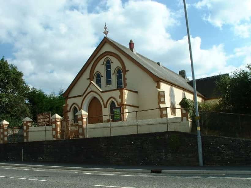
    Burraton Methodist Church

    The village chapel of Burraton, out towards the Liskeard road — Cornish Methodism in its plainest form.

    Burraton Methodist Church
    Photo by Kevin Hale, Geograph Britain and Ireland, CC BY-SA 2.0

    Burraton Methodist Church is the chapel of Burraton, the older settlement that has now grown together with Saltash on its western side, out towards the Liskeard road. Like Saltash Wesley down the hill, it belongs to the Methodist inheritance that shaped Cornish working life more strongly than the established church ever did — a village chapel of the kind that once stood in almost every Cornish community, built and paid for by its own congregation rather than by any distant patron. Burraton had its own industrial past, with a tannery, quarrying and the trades that clustered along the road, and the chapel served the families who worked them. It continues as a Methodist church today, a modest building that has outlasted much of the industry around which it grew.

    An active Methodist church on the town's western edge.

    Liskeard Road, Burraton, Saltash, Cornwall · PL12 4FD

    Street View

  9. 09Historic quayside district50.4072° N · 4.2064° W

    Saltash Waterside

    Where the town meets the river: gig boats, deep mud at low tide, and the best seat in Cornwall.

    Saltash Waterside
    Photo by Rod Allday, Geograph Britain and Ireland, CC BY-SA 2.0

    The Waterside area of Saltash has been continuously inhabited for at least a thousand years, owing its existence to its position within the Saxon manor of Trematon at the point where a major highway crossed the Tamar estuary by ferry. Long before the railway or road bridges were built, this was the beating heart of the town — a place where boatmen, fishermen, and ferrymen lived crowded together in narrow streets of houses, many dating from the sixteenth century and still standing today. The ferry crossing itself is recorded as having been established by fishermen serving travellers heading to and from the monastery at St Germans and Trematon Castle, and Saltash's entire name and identity are rooted in this ancient 'passage' across the river. The Waterside prospered as a centre for fishing, particularly for Tamar salmon and oysters, and for shipbuilding and river trade, and its steep, cobbled lanes down to the water still preserve much of their historic character. Today Waterside is a conservation area popular for its riverside pubs, views of the two great bridges, and its role as a living reminder of Saltash's origins as a ferry town.

    Slipway, seating and level access. Two pubs and a tea room.

    Waterside, Saltash, Cornwall · PL12 4EL

    Street View

  10. 10Historic shop / museum50.4086° N · 4.2097° W

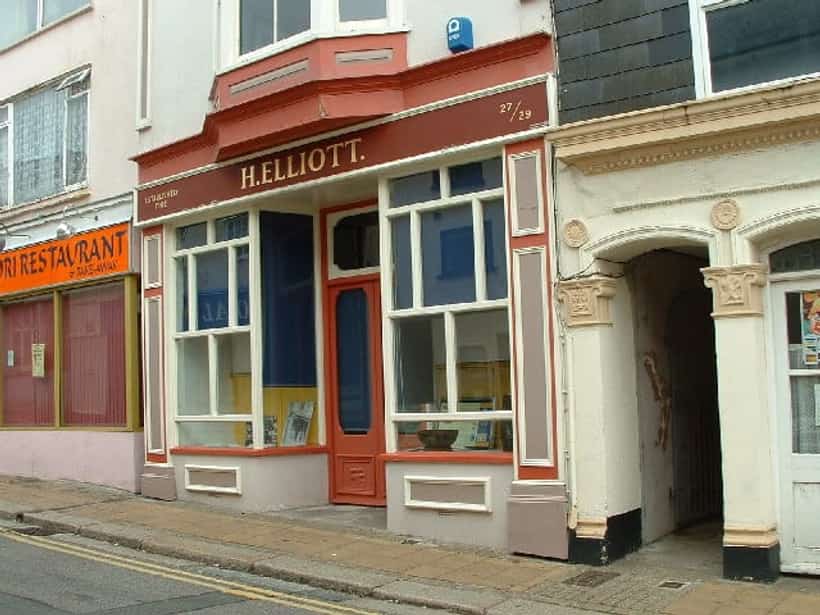
    Elliott's Shop and Museum

    An Edwardian grocer's, closed in the 1970s and left exactly as it was.

    Elliott's Shop and Museum
    Photo by Kevin Hale, Geograph Britain and Ireland, CC BY-SA 2.0

    Elliott's Shop began life as a butcher's premises — meat hooks are still visible in the cornice today — before becoming a grocery store in 1880. Its story as a family institution truly began on Boxing Day 1895, when Harry Elliott married Laura Ede in Tintagel. In 1902 the couple and their three children moved into the Fore Street building, which was owned by Laura's uncle Richard Miller, and the name 'H. Elliott' appeared over the door for the first time. The shop traded as a working grocery store for decades, serving generations of Saltash residents, before finally closing in the 1970s, by which point it had become something of a time capsule of Edwardian and early-to-mid twentieth century retail life. Frank Elliott, a later member of the family, fought for years — taking the matter to court multiple times — to have the shop legally preserved as a museum rather than reclassified for business rates, finally winning his case in his nineties. Today Elliott's Shop and Museum preserves its original shop layout, fittings, and packaging, along with the family's living quarters above, offering visitors an intact window into everyday commercial and domestic life in Saltash from the Edwardian era through to the late 1990s.

    Preserved after a decades-long legal fight by Frank Elliott. Opening hours vary.

    Fore Street, Saltash, Cornwall · PL12 6AH

    Street View

  11. 11Museum / local history centre50.4086° N · 4.2100° W

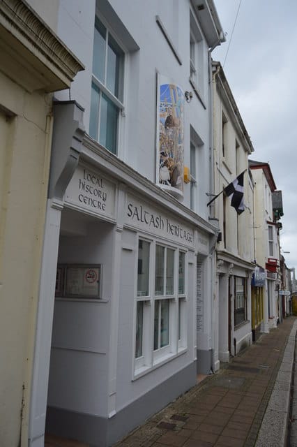
    Saltash Heritage Museum

    The town's own museum and local history centre — the institutional memory the borough itself never kept.

    Saltash Heritage Museum
    Photo by N Chadwick, Geograph Britain and Ireland, CC BY-SA 2.0

    Saltash Heritage was founded in 1986 with three aims: to gather together the objects and records that tell the history of Saltash and the district around it, to encourage local interest in that history, and to give the town a museum of its own. The gathering came first and the buildings followed — the Local History Centre opened in July 1997, and the museum itself in July 2000, in a modest shopfront at 17 Lower Fore Street on the hill running down towards the water. It is an independent registered charity with no public funding behind it, kept going by its members, by donations, and by something like fifty volunteers who staff the desk, catalogue the collection and mount a fresh exhibition each year. What it holds is the ordinary documentary record of a small town that most places lose: photographs, maps, newspaper cuttings, family and parish records, the papers of vanished businesses, and the recollections of people who worked the ferry, the yards and the railway. For anyone tracing a Saltash family or a Saltash building it is the first place to go, and for the town it is the institutional memory that the borough itself never kept. The society has been working towards a move to larger premises at 54 Fore Street, the former Hearing Centre, which will give both the museum and the history centre considerably more room than the Lower Fore Street shop allows.

    Run by volunteers, so opening is seasonal and limited; check before travelling. A new exhibition each year, and a research service for family and house history.

    17 Lower Fore Street, Saltash, Cornwall · PL12 6JQ

    Street Viewessanian.org.uk

  12. 12Railway station50.4074° N · 4.2091° W

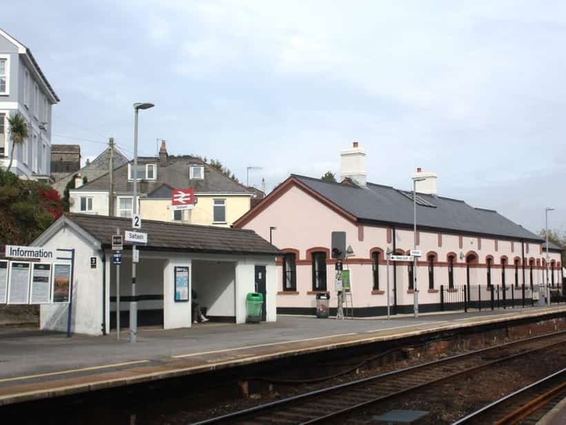
    Saltash Railway Station

    Opened two days after the bridge it stands beside; restored by the town in 2021.

    Saltash Railway Station
    Wikimedia Commons (via Wikipedia infobox)

    Saltash railway station opened on 4 May 1859, just two days after Brunel's Royal Albert Bridge was formally inaugurated, as part of the Cornwall Railway's new 53-mile main line linking Plymouth to Truro. Its opening marked the moment Cornwall was finally connected directly to the national rail network, ending centuries of relative isolation for the county and transforming Saltash into a gateway settlement immediately west of the Tamar crossing. The original station buildings, designed under Brunel's influence, featured brick construction with stucco walls and slate roofing, and the station underwent significant rebuilding in 1880 and again in 1906 following the Cornwall Railway's absorption into the Great Western Railway in 1889. Through the twentieth century the station saw the usual cycles of Victorian expansion, wartime service, and post-war rationalisation common to branch and main-line stations across Britain. In 2017, Saltash Town Council purchased the historic station building and, working with Cornwall Council, Great Western Railway, Network Rail, and the Railway Heritage Trust, undertook a major restoration project. The refurbished building reopened to the public in November 2021, now housing a waiting room, toilets, refreshment facilities, and a community hall, giving the historic structure a renewed civic purpose alongside its continuing role as a working station on the Cornish main line.

    Seven minutes from Plymouth. Waiting room, café and community hall.

    Station Road, Saltash, Cornwall · PL12 4AJ

    Street View

  13. 13Norman castle (motte and bailey)50.4005° N · 4.2377° W

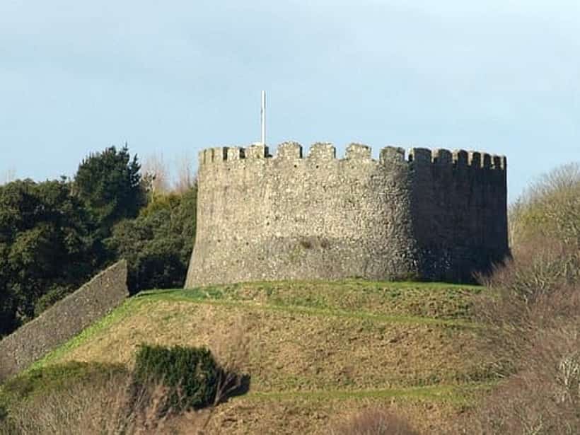
    Trematon Castle

    A Norman shell keep above the Lynher, still owned by the Duchy of Cornwall after 700 years.

    Trematon Castle
    Geograph Britain and Ireland, via Wikimedia Commons

    Trematon Castle was raised around 1068-1070 on the orders of King William I as part of the Norman effort to suppress uprisings in Devon and Cornwall shortly after the Conquest, and was built by Robert, Count of Mortain, the king's half-brother, on the site of an earlier Roman fort. It occupies a commanding position overlooking the Lynher estuary, chosen to guard what was then the 'highway' serving St Germans, Cornwall's second most important town of the period. The Domesday Book of 1086 records Robert of Mortain holding most of Cornwall, including Trematon, with Reginald de Valletort as his tenant; either Robert or Reginald subsequently founded the Borough of Trematon alongside the castle and its market, which relied on the fortress for protection. Initially built of earth and timber, the castle was steadily rebuilt in stone: the keep in the twelfth century and the bailey wall in the thirteenth, with the well-preserved gatehouse dating from around 1300. In 1270, Roger de Valletort sold the castle and its barony to Richard, Earl of Cornwall, and when the earldom later became extinct its possessions passed into the newly created Duchy of Cornwall, established by Edward III in 1337 for his son, the Black Prince. Remarkably, the Duchy of Cornwall still owns Trematon Castle today, making it one of the longest continuously held estates connected to the English Crown, and its ruins remain one of the best-preserved Norman shell-keep sites in the county.

    Privately held. The gardens open on select days — check ahead.

    Trematon, near Saltash, Cornwall · PL12 4QW

  14. 14Historic hamlet / creekside settlement50.4014° N · 4.2360° W

    Forder

    A ford, a mill and a creek under the railway — the hamlet the main line steps straight over.

    Forder
    Photo by Jeff Collins, Geograph Britain and Ireland, CC BY-SA 2.0

    Forder is an ancient hamlet tucked into a tidal creek off the River Lynher, a mile or so west of Saltash and directly below Trematon Castle, and its name records exactly what it was: the ford where the road between Trematon and St Stephens crossed the water. Far from being the quiet backwater it now appears, medieval Forder was a working settlement, with quarrying, lime burning, fulling, market gardening and flour milling all carried on around the creek — and the water mill where the tenants of Trematon Manor were obliged to bring their grain to be ground still stands beside the road, its mill pond and embankment on the tidal inlet known as Forder Lake surviving to this day. The hamlet's most dramatic feature arrived with the railway: Brunel built one of his timber viaducts across Forder Lake for the Cornwall Railway, a structure some 67 feet high and 606 feet long carried on sixteen trestles, which loomed over the cottages for half a century. It was demolished after 19 May 1908, when the line was rerouted onto a straighter inland alignment — the Wearde deviation — carried on a new masonry viaduct that still strides across the creek above the village today, and which remains the crossing that trains to Cornwall take. Forder is now a conservation-minded huddle of cottages beside the stream, reached down steep lanes, and one of the quietest corners of the parish despite the main line passing overhead.

    Steep lanes down from Trematon; park considerately. The mill pond and viaduct are the walk.

    Forder, near Trematon, Saltash, Cornwall · PL12 4QR

    Street View

  15. 15Community nature reserve50.3978° N · 4.2278° W

    Churchtown Farm Community Nature Reserve

    A hundred and fifty acres of meadow, wood and shoreline on the peninsula below the town, wrapped in tidal water on two sides.

    Churchtown Farm Community Nature Reserve
    Photo by Derek Harper, Geograph Britain and Ireland, CC BY-SA 2.0

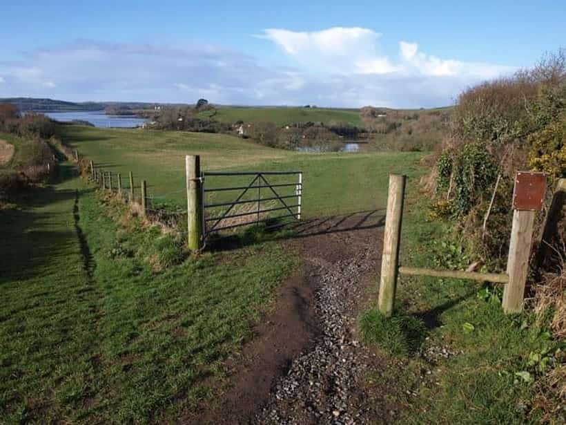
    Churchtown Farm Community Nature Reserve covers some 61 hectares — just over 150 acres — of farmland, woodland and shoreline on the peninsula immediately south of Saltash, wrapped on two sides by the tidal waters of the Lynher and the Tamar. It is leased from the Antony Estate and managed by Cornwall Wildlife Trust, for whom it is among the largest reserves in the county, and the whole of it lies within the Tamar Valley Area of Outstanding Natural Beauty. Its variety is the point: hay meadows and arable fields give way to hedgerows, woodland and wetland, and then to a rocky shoreline looking out over the estuarine mudflats where oystercatchers, dunlin, egrets, avocets and greenshank feed on the falling tide. The land carries its industrial past as well. Two disused quarries lie within the reserve — Forder and Lowhill, both now County Geological Sites — which were worked through the nineteenth century for the hornblende-rich dolerite used as roadstone, Lowhill closing in 1915. Much of the farm was managed intensively from the 1960s, reseeded with productive rye grass and kept up with heavy grazing and chemical fertiliser, which enriched the soil and left pastures of very few species; the Trust's work since has been the patient reverse of that, stripping nutrients back out of the ground to let a wider range of plants and the wildlife that depends on them return. The reserve is wardened by the Friends of Churchtown Farm, formed in 2001, who run an annual programme of guided walks and beach cleans and keep the paths open for the town.

    Free and open all year. Park by St Stephen's Church or on Wearde Road; paths are unsurfaced and steep in places. Guided walks run through the year.

    Off Wearde Road, St Stephens, Saltash, Cornwall · PL12 4AY

    Street Viewchurchtownfarm.saltash.website

  16. 16Historic quay / riverside hamlet50.3982° N · 4.2165° W

    Wearde Quay

    A lime kiln, a slipway and the moorings where the first ship-to-ship radio message was sent.

    Wearde Quay
    Photo by Derek Harper, Geograph Britain and Ireland, CC BY-SA 2.0

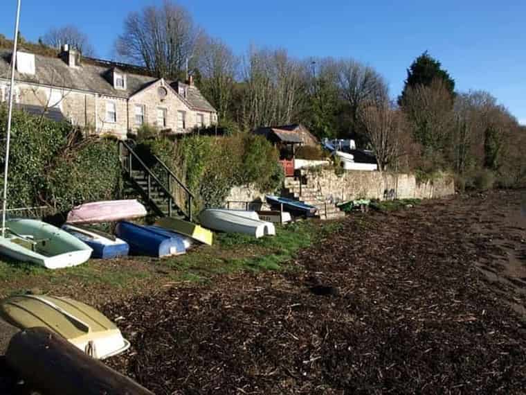
    Wearde Quay is a small huddle of cottages and a stone quay on the south bank of the Lynher, below the Churchtown Farm reserve and a mile or so from the centre of Saltash, at the point where the Lynher runs out to meet the Tamar. The cottages date from around 1800 and are listed, and beside them stands a lime kiln fronting the river, itself Grade II listed — the surviving evidence of the trade that gave the quay its purpose. Limestone and coal were brought upriver by barge and burnt here, the quicklime going out onto the fields of a countryside whose soils were too sour to farm well without it, and just beyond the kiln lies Mann's Quay, worked in connection with the quarries inland. What lifts Wearde Quay beyond the ordinary run of Cornish lime quays is what was moored off it. From 1886 the Royal Navy's torpedo school, HMS Defiance, lay in the Lynher directly off the quay, a hulk fitted out for instruction in the new science of underwater weapons. It was aboard Defiance, in 1896, that Captain Henry Jackson carried out the experiments that made him the first person anywhere to achieve ship-to-ship wireless communication, demonstrating continuous contact with another vessel up to three miles away — work he pursued independently of Marconi and at almost exactly the same moment. Jackson went on to be First Sea Lord. The quay today is quiet: a slipway, boats drawn up on the foreshore, and a view across the water that has changed very little since the Defiance swung at her moorings.

    Reached on foot through Churchtown Farm, or down the lane off Wearde Road. No parking at the quay itself.

    Wearde Quay, St Stephens, Saltash, Cornwall · PL12 4AT

    Street View

  17. 17Football ground50.4098° N · 4.2234° W

    Kimberley Stadium

    Home of Saltash United since 1969 — three Western League titles in the eighties, and football in the town since the 1890s.

    Kimberley Stadium
    Photo by Kevin Hale, Geograph Britain and Ireland, CC BY-SA 2.0

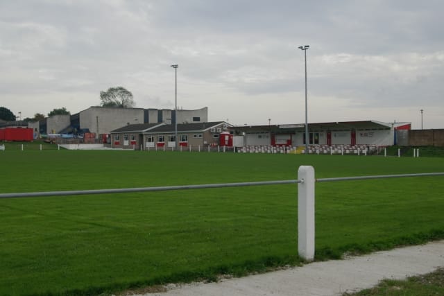
    Kimberley Stadium is the home of Saltash United, the town's senior football club, and has been since its pavilion was formally opened in April 1969 with an exhibition match against Plymouth Argyle that drew more than seven hundred people. The club's own story runs deeper than the ground: organised football in Saltash goes back to the 1890s, when a side called Essa played on the higher ground above the town, and by the late 1920s its successor, Saltash Stars, was good enough to carry off the Cornwall Senior Cup three years in a row from 1929. Disbanded during the Second World War, the club reformed for the 1946-47 season as Saltash United and has run under that name ever since, moving to the Kimberley ground when its earlier field became hard to reach. The great years came in the 1980s, when the Ashes — as the club is known, for the black-and-white of its shirts — won the Western League Premier Division three times in five seasons. They play there still, a good level of non-league football on a tight ground with a covered terrace, floodlights and a clubhouse, a short walk up from Callington Road.

    Non-league football through the winter. Turnstiles on match days; the clubhouse is open to visitors.

    Tobruk Road, off Callington Road, Saltash, Cornwall · PL12 4HP

    Street Viewsaltashunited.co.uk

  18. 18Rugby ground50.4143° N · 4.2355° W

    Saltash Rugby Club

    The town's rugby club since 1969, at Moorlands Lane above the Latchbrook valley — seniors down to Sunday-morning minis.

    Saltash Rugby Football Club is the younger of the town's two winter clubs, formed in 1969 and playing its first matches on the pitches of the comprehensive school before it found ground of its own. Since the early 1980s its home has been at Moorlands Lane, on the northern edge of the town above the Latchbrook valley, with a second pitch at the Chapel Field nearby and a clubhouse that has long been the social heart of the club. Rugby came late to Saltash compared with football, which had been played here since the 1890s, but the club took root quickly and now runs sides the whole way down the age range, from a senior first XV through colts and juniors to the minis who fill the pitches on a Sunday morning. It is a community club in the truest sense — no professional pretensions, run by volunteers, and as much about the winter Saturdays in the clubhouse afterwards as the eighty minutes on the field.

    Home matches on winter Saturdays. Clubhouse and a second pitch at the Chapel Field.

    Moorlands Lane, Saltash, Cornwall · PL12 4HJ

    Street Viewsaltashrfc.com

  19. 19Cricket ground50.4102° N · 4.2177° W

    Saltash Cricket Club

    Summer cricket on the Recreation Ground below Longstone, where the town has played since the 1920s.

    Saltash Cricket Club plays its summer cricket at the Recreation Ground below Longstone, on the high ground north of the town centre where the reservoir known as the 'green tank' stood until 1979. The recreation ground has been the town's sporting common since the 1920s — the bowling club was among the first to use it, in 1923 — and cricket has been played across it for generations, the sound of a summer afternoon in this corner of Saltash. The club today runs three senior sides in the Cornwall Cricket League, playing across the eastern divisions, and takes in players from across the district around the town. It is, like the rugby and the football, a wholly volunteer-run affair, dependent on the people who roll the wicket, staff the tea and turn out week after week through a Cornish summer that does not always cooperate.

    Three senior sides in the Cornwall Cricket League. Matches most summer weekends.

    Recreation Ground, Longstone, Saltash, Cornwall · PL12 6DU

    Street Viewsaltashcc.play-cricket.com

  20. 20Geological landmark / community centre50.4078° N · 4.2058° W

    Ashtorre Rock

    The blue elvan outcrop that made the crossing possible — now a volunteer tea room with the finest view on the estuary.

    Ashtorre Rock
    Photograph by Mausti.Net

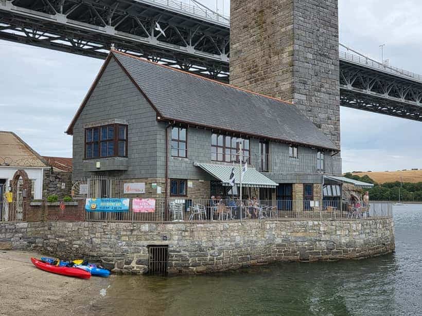
    Ashtorre Rock is a distinctive outcrop of 'blue elvan' volcanic rock, geologically much more recent than the Devonian slate that underlies most of the Saltash area, and it juts prominently into the Tamar Estuary at its narrowest point. This natural rock formation has shaped human use of the site since the earliest times, because it created a firmer, more suitable landing point for boats than the surrounding muddy shoreline, helping to establish and protect the ancient river crossing from which Saltash takes its name and purpose. Sitting directly beneath the modern Tamar Bridge and Royal Albert Bridge, the rock has effectively watched over every phase of the crossing's history, from the earliest ferrymen through to the age of rail and motor traffic. In more recent times the site has been redeveloped as a community hub: Ashtorre Rock is now home to a volunteer-run community tea room and centre, open to the public throughout the week, which regularly hosts local art exhibitions and live music events, keeping the historic riverside site active as a gathering place for the town.

    Community centre and tea room, open most days. Art and live music.

    Old Ferry Road, Saltash, Cornwall · PL12 4GT

    Street View

  21. 21Historic public house50.4072° N · 4.2067° W

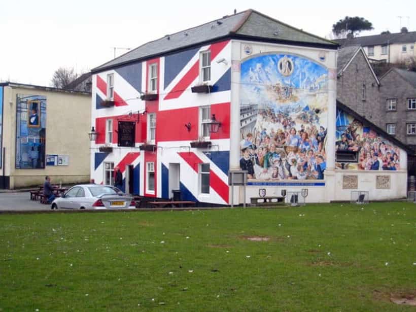
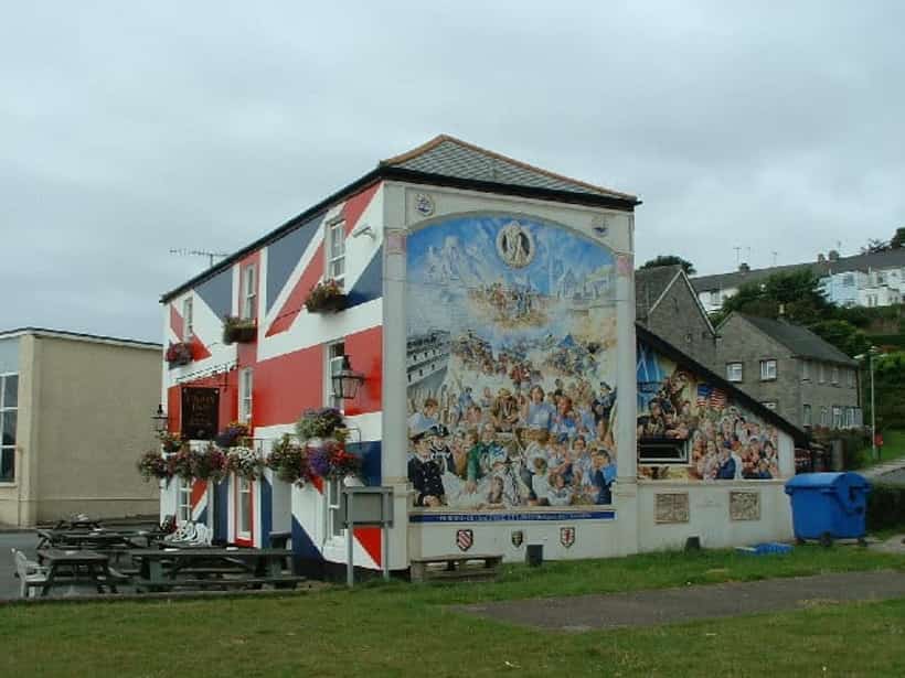
    Union Inn

    A riverside pub behind a Union Jack, on a lane once called Picklecock Alley.

    Union Inn
    Photo by Kevin Hale, Geograph Britain and Ireland, CC BY-SA 2.0

    The Union Inn dates back to the early 1800s and sits directly on the banks of the River Tamar in Saltash's historic Waterside quarter, in a street once known by the memorable name 'Picklecock Alley' — so called because local traders sold shellfish to passers-by through open windows along the lane. Like much of Waterside, the pub's history is tied closely to the river trades of fishing, boatbuilding, and ferrying that sustained the town for centuries before the road and rail bridges were built. One of its notable historical connections is to a former landlord, Leading Seaman William Odgers VC, who was awarded the Victoria Cross for gallantry during the New Zealand (Maori) Wars of 1860, later returning to civilian life to run the inn. The Union Inn's exterior is instantly recognisable for its bold Union Jack-painted facade, a distinctive local landmark visible from the water. It remains a working pub today, known for real ales, live music, and unobstructed views across the Tamar towards Devon, continuing a tradition of riverside hospitality that stretches back more than two centuries.

    Real ale and unobstructed views across the Tamar to Devon.

    Tamar Street, Saltash, Cornwall · PL12 4EL

    Street View

  22. 22Sailing club50.4067° N · 4.2067° W

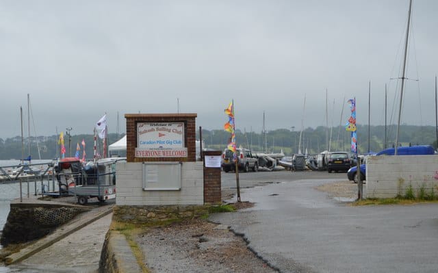
    Saltash Sailing Club

    Racing on the Tamar since 1898, from the slipway where the town's gas works used to stand.

    Saltash Sailing Club
    Photo by N Chadwick, Geograph Britain and Ireland, CC BY-SA 2.0

    Saltash Sailing Club was established in 1898 and has been racing on the Tamar ever since, from a hard and slipway on the Cornish bank a little south of the two bridges, where the tide runs hard and the wind comes down the estuary in a way that has taught generations of local sailors their trade. The clubhouse stands on Tamar Street at the Waterside, on ground that was once the town's gas works: the site was cleared and given over to the club during the long Waterside redevelopment that ran through to 1966, one of the more useful exchanges in the town's history — a coal-fired works for a place to keep boats. That continuity matters more than it might appear, because of the many trades that once crowded this shore — boatbuilding, lime burning, fishing, ferrying, a foundry, a quarry — only three are still carried on at the Waterside today, and they are fishing, inn-keeping and sailing. The club runs racing and cruising for both dinghies and yachts, and shares its site with the Caradon Pilot Gig Club, whose crews row the six-oared Cornish pilot gigs that are among the oldest working boat types in Britain and the reason the river is still busy on a regatta weekend.

    Members' club, but the hard and the slipway are part of the Waterside scene. Visiting sailors welcome — see the club for moorings.

    Tamar Street, Waterside, Saltash, Cornwall · PL12 4EL

    Street Viewsaltashsailingclub.co.uk

  23. 23Youth project / music venue50.4071° N · 4.2068° W

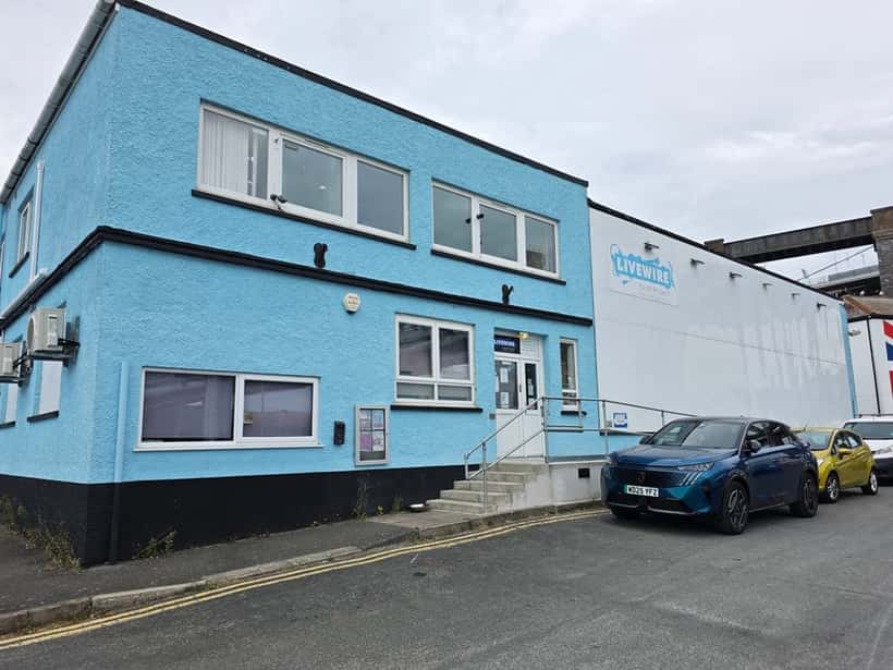
    Livewire Youth Project

    A 250-capacity music venue and youth project in a blue hall under the bridge — eighty years on the Waterside.

    Livewire Youth Project
    Photograph by Mausti.Net

    Livewire is one of the oldest institutions on the Waterside, and one of the least expected — a music venue and youth project in a blue-painted hall in the shadow of the Royal Albert Bridge, celebrating some eighty years on the same spot. It began in the years after the Second World War as the Waterside Boys Club, later the Saltash Boys Club, giving the town's young people somewhere to go when there was little else; the change of name to Livewire came with a change of purpose, though the thread of youth work has never been cut. Its transformation into a genuine music venue is the work of Andy Rance, a volunteer since 1990 and its driving force since 1997, who oversaw the conversion of the old sports hall into a live performance space holding some 250 people — a real stage, on real equipment, in a town that had nowhere else to play. Around the gigs runs the everyday work of the charity: lessons in guitar, bass, drums, keyboard, vocals, digital music and DJing, and support for young people at risk of exclusion from school or struggling with life. After the loss of one of its members in 2018 the project added mental-health counselling to what it offers, a reminder that a youth club on the Waterside has always been about more than the music. It is a registered charity, run on a shoestring and a great deal of volunteer time, and one of the genuinely important places in the town.

    Live music, lessons and youth work. Gigs are open to the public; see the project for what's on.

    Brooke Close, Waterside, Saltash, Cornwall · PL12 4EN

    Street Viewlivewireyouth.com

  24. 24Historic house / museum50.4068° N · 4.2079° W

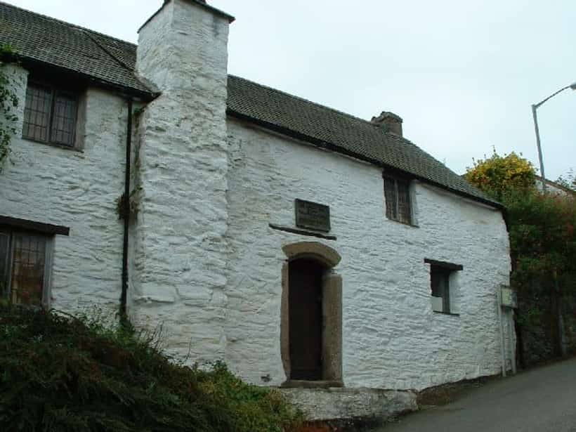
    Mary Newman's Cottage

    The oldest intact building in town, and the subject of its most stubborn legend.

    Mary Newman's Cottage
    Photo by Kevin Hale, Geograph Britain and Ireland, CC BY-SA 2.0

    Mary Newman's Cottage is a small, timber-framed house on Culver Road, close to Saltash's Waterside, dating from around 1480 and generally regarded as the oldest intact building in the town. It takes its name from a long-standing local tradition that it was the childhood home of Mary Newman, born in Saltash around 1552, the daughter of a 'gentleman mariner' named Richard Newman, and that this is where she lived before marrying the young sea captain Francis Drake — later Sir Francis Drake, the famous Elizabethan explorer — on 4 July 1569 at the church of St Budeaux, near Plymouth. Mary Newman died childless in January 1582, and Drake went on to marry Elizabeth Sydenham four years later. Historians have since raised serious doubts about the Saltash tradition: while the cottage itself certainly predates Mary's birth, there is no direct documentary evidence placing her in it, and the association cannot be traced back further than around 1800, with its popularity boosted considerably by civic pageants staged in Saltash during the 1930s. Regardless of the uncertain provenance of the Drake connection, the building itself is an authentic and rare survival of a late-medieval Cornish cottage, saved from demolition and carefully restored by the Tamar Protection Society. It is now run as a small museum, furnished with Tudor-style furniture, utensils, and textiles, with a recreated Tudor herb garden behind it, and forms part of the Saltash Heritage Trail marked by the town's black-and-gold signage.

    Volunteer-run museum with a Tudor herb garden. Open seasonally.

    48 Culver Road, Saltash, Cornwall · PL12 4DS

    Street View

  25. 25Historic public house50.4085° N · 4.2102° W

    The Railway Inn (Railway Hotel)

    A Victorian railway hotel at the top of Fore Street, hung with photographs of the old town.

    The Railway Inn, also known historically and today as the Railway Hotel, stands on Fore Street directly opposite the junction with North Road, on the upper part of Saltash's historic main street leading down towards Waterside and the Tamar. It is a Victorian building, put up in the nineteenth century in the wake of the arrival of the Cornwall Railway and Brunel's Royal Albert Bridge in 1859, when Saltash's growth as a railway town created demand for lodging and refreshment aimed at railway workers, passengers, and travellers passing through on the newly opened line to Plymouth and beyond — hence its name and enduring association with the railway rather than with the river trades that named most of the town's older Waterside pubs. Like many Victorian railway-era hotels, it combined a public bar with hotel accommodation for travellers, a common model in towns transformed by the arrival of the rail network in the mid-1800s. The pub has continued trading more or less continuously since, passing through various brewery and licensee hands over the decades; it is now run as a community local under the Craft Union Pub Co banner. Inside, the pub retains a collection of framed photographs of old Saltash, a nod to its own long history and that of the town growing up around the railway that gave it its name.

    Community local at the Fore Street and North Road junction.

    1-3 Fore Street, Saltash, Cornwall · PL12 6AF

    Street View

  26. 26Country club / leisure resort50.4236° N · 4.2142° W

    China Fleet Country Club

    Country club / leisure resort

    China Fleet Country Club spreads across 180 acres above the Tamar at North Pill, on the northern edge of Saltash, and carries one of the more surprising names in Cornwall — for it began not here but in Hong Kong. The original China Fleet Club opened in Victoria Harbour in the early 1900s, when a Hong Kong businessman joined with Royal Navy personnel to build a canteen and rest house for the sailors of the China Station; rebuilt in 1929 as a seven-storey block whose foundation stone was laid by Admiral Kelly, Commander-in-Chief of the station, and known to generations of sailors simply as 'The Old Blue', it served the fleet through the Japanese occupation of Hong Kong, the Korean War and Vietnam. As the 1997 handover of Hong Kong to China approached, the club's trustees realised its days on Victoria Harbour were numbered, sold the value of the old building, and looked for a home on British soil — settling in the late 1980s on this estate on the Cornish bank of the Tamar. The Saltash country club opened on 1 June 1991 and was formally opened by the Prince of Wales that December, with an eighteen-hole golf course laid out by Martin Hawtree; the Hong Kong club closed its doors for the last time on 30 November 1992, ahead of the handover. Run by the China Fleet Trust as a military charity, it exists first to serve the Royal Navy and Royal Marines community — with modern affiliations to HMS Tamar and 47 Commando Royal Marines — but since 1994 it has opened to the wider public as well, and is now one of the largest leisure destinations in the district, with a health club and pools, a spa, the golf course and driving range, restaurants and four-star accommodation looking out over the estuary.

    North Pill, Saltash, Cornwall · PL12 6LJ

    Street Viewchina-fleet.co.uk

  27. 27Leisure centre / swimming pool50.4095° N · 4.2220° W

    Saltash Leisure Centre

    Leisure centre / swimming pool

    Saltash Leisure Centre stands on Callington Road on the northern side of the town, among the cluster of public buildings — the health centre, the football ground and Brunel school — that grew up along the road out towards Callington. It grew from a modest swimming pool opened here in the 1950s, expanded and rebuilt over the decades into the multi-purpose centre it is today: a main pool of four lanes, a learner pool with a water slide and fountains for children, a gym fitted out with Technogym equipment, and a full timetable of fitness and swimming classes. Like most of Cornwall's public leisure centres it is owned by Cornwall Council and run on the council's behalf by the charitable social enterprise GLL, under its 'Better' brand, which keeps the pool and gym open to the public and to the town's schools and clubs. For a town of Saltash's size it is the main indoor sports facility, and the place where most local children learn to swim.

    Callington Road, Saltash, Cornwall · PL12 6DJ

    Street Viewbetter.org.uk/leisure-centre/cornwall/saltash-leisure-centre

Getting here

Arriving

By train

Saltash sits on the Cornish Main Line, seven minutes from Plymouth. Sit on the right leaving Plymouth: the train crosses Brunel's bridge and the whole estuary opens beneath you.

By road

The A38 crosses the Tamar Bridge into the town. Tolls are charged eastbound only, into Plymouth. Park at the station or the Waterside and walk — these streets are steep and old and were not built for cars.

On foot & water

Footways run along both sides of the Tamar Bridge. The Saltash Heritage Trail, marked in black and gold, links the landmarks above; riverside paths lead north into the Tamar Valley.

Picture credits

Photographs are reproduced from Wikimedia Commons and Geograph Britain and Ireland under CC BY-SA 2.0, with the photographer credited beneath each image. Coordinates are WGS84.